Ibeju-Lekki · Lagos State · Nigeria
We build the housing and the city that goes around it.
Dududa Smart City is a 200-acre development with frontage on the Lagos–Calabar Coastal Highway. Roads, water, power and connectivity first; then homes, schools, a hospital and a market — run as a working city rather than sold off as plots.
- Phase 1 site, Ibeju-Lekki
- 200acresPhase 1 site, Ibeju-Lekki
- Across the full programme
- 2,580homesAcross the full programme
- At full occupancy
- ~9,300residentsAt full occupancy
- Build programme
- 84monthsBuild programme
The site
On the corridor Nigeria is actually building
The Lagos–Calabar Coastal Highway runs along the Atlantic seaboard through Ibeju-Lekki. Within a short haul of the site: the deepest port in West Africa, the Dangote refinery, an established free zone, and the point where four subsea cables come ashore. We did not create that demand — we are building housing and services next to it.
The corridor today
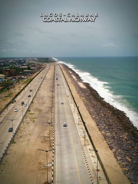
The completed carriageway on the Atlantic edge, rock armour holding the shoreline.
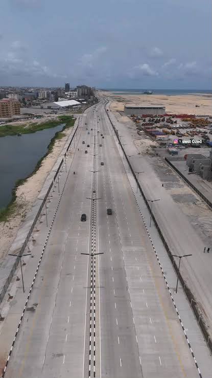
A finished section in use, lagoon on one side and working yards on the other.
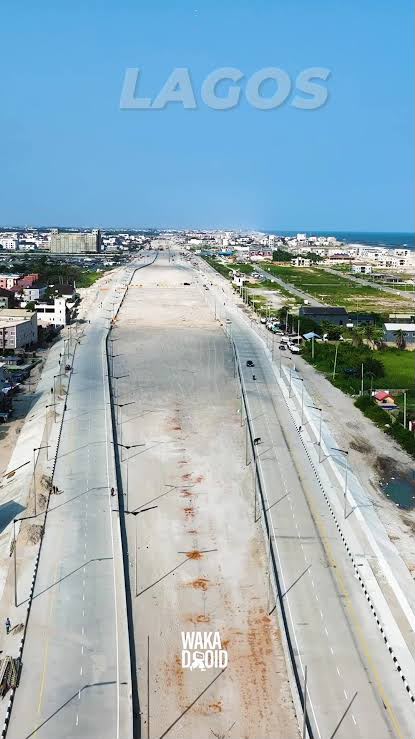
Concrete laid through the built-up Lagos stretch, the ocean beyond.
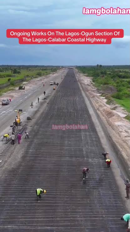
Works in progress: crews laying sub-base on an open section.
Lekki Deep Sea Port
West Africa's deepest port. Puts container and project cargo within a short haul of the site.
Dangote Refinery & Petrochemicals
The largest single-train refinery in the world, and the corridor's biggest employer of skilled labour.
Lekki Free Zone
Established industrial and manufacturing base already drawing tenants and workforce to Ibeju-Lekki.
Subsea cable landings
Equiano, 2Africa, MainOne and Glo-1 come ashore on this coast. That proximity is what makes an edge data centre viable here and nowhere inland.
Lagos–Calabar Coastal Highway
The federal coastal carriageway under construction along the Atlantic seaboard, giving the site direct frontage and onward access east.
How we think
Four decisions that shape everything else
Infrastructure before plots
Roads, drainage, water, power and connectivity go in first. Most African estates sell land and leave services to the buyer; that is why they stall half-built. We carry the horizontal cost up front and recover it through serviced land value and utility revenue.
Housing people can actually pay for
Mixed-income by design, not by afterthought. Key workers — teachers, nurses, drivers, tradespeople — get homes in the first phase, not in a phase that never comes. Density is added later on land that is already serviced.
A city that keeps earning
Power, water, connectivity, schooling, clinics, market space and digital services are operated, not sold off. In the modelled year seven, about 63% of revenue is recurring. That is the difference between a development and an estate sale.
Built to be repeated
Everything here is a template: the land budget, the phasing, the utility model, the software. The second city should be faster and cheaper than the first, and the tenth faster again.
Delivery
84 months, four phases
Each phase is designed to stand on its own: services in, buildings up, people living there, revenue running — before the next phase breaks ground.
- Phase 1Months 0–24
Land, horizontal infrastructure and the first neighbourhood
- Site acquisition, survey, titling and environmental impact assessment
- Primary roads, drainage, water treatment and the solar-plus-storage plant
- Edge data centre shell and first megawatt of IT load
- First residential release and the civic core groundworks
- Phase 2Months 24–48
Commercial anchor and social infrastructure
- Business and technology district first buildings, leased not sold
- District hospital and the primary and secondary schools open
- Retail spine and covered market trading
- Second and third residential releases
- Phase 3Months 48–66
Density, park and innovation park
- Central park, wetland works and sports precinct complete
- Innovation park buildings alongside the expanded data centre
- Technical college opens
- Mid-rise residential density added on serviced land
- Phase 4Months 66–84
Completion and stabilised operations
- Final residential releases and full occupancy push
- Utilities, connectivity and services running as a stabilised operating business
- Second-city site selection using the same playbook
The digital layer
The software is already built and running
A “smart city” usually means sensors nobody maintains. Here it means six services that already operate commercially inside the group, deployed to residents from day one instead of procured from scratch.
Resident identity and verification
AfriID & IDVero
One verified identity per resident and business, reused for tenancy, school enrolment, clinic records and utility accounts instead of a new paper file at every counter.
Payments and wallets
Paylio
Rent, levies, utilities and market takings settle through multi-currency wallets rather than cash runs.
Education operating system
SchoolID
Enrolment, attendance, fees and reporting for every school in the city on one multi-tenant system.
Health access
Sisi Nurse
Nurse and doctor matching connecting neighbourhood clinics to the district hospital and to home visits.
Legal and title services
Legal Buddy
Tenancy agreements, title queries and dispute triage handled without a trip to a distant chambers.
Network and connectivity
AfriVPN
Secure connectivity across the city network, running off the same edge infrastructure as the data centre.
Phase 1 is open to capital partners.
US$67M to deliver the first phase, of which US$50M is the raise. The rest is covered by pre-sales and the platform contributed in kind. Full figures, assumptions and the phasing model are on the investment page.